

If toll-free driving sounds too good to be true, it probably is.
Expensive toll roads, vehicle maintenance, fuel and tire costs are all part of what makes being a trucker a pricey profession.
Toll roads are usually the quickest and most direct routes for making pickups and deliveries. On the other hand, the cost of tolls quickly adds up and continues to get more expensive.
It’s important to have all the toll road information available before you start driving, so you won’t face any unpleasant surprises at toll crossings. Be aware of the costly routes and calculate them into your cost per mile before you hit the road.
1. Alabama
- Tuscaloosa ByPass
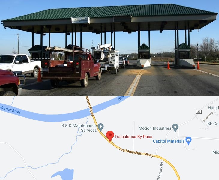
Tuscaloosa By-Pass acts as a western bypass of the City of Tuscaloosa in addition to providing an alternate route for the western and northern communities to cross the Black Warrior River in Tuscaloosa County.
It connects US 82 and I-20/I-59, as well as Highway 171, 43, 69N and 69S.
Toll rate: https://www.tuscaloosabypass.com/Toll.aspx
- Emerald Mountain Expressway
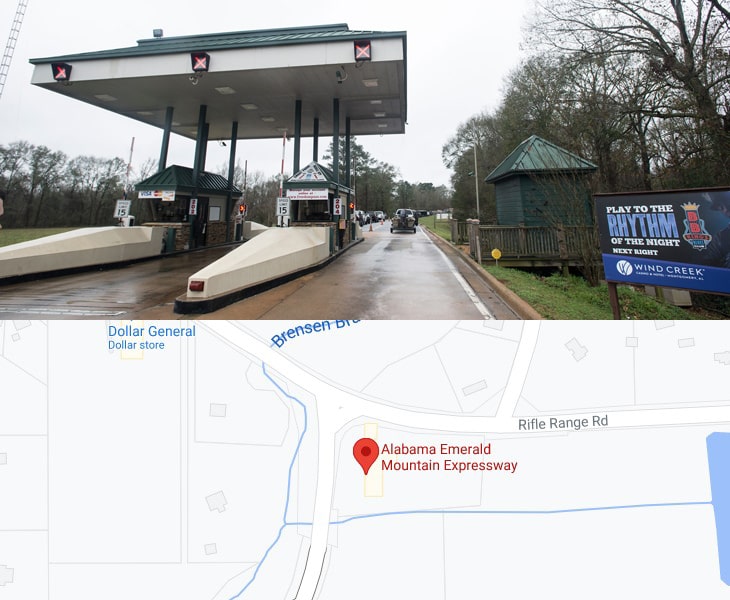
The Emerald Mountain Expressway is an alternative to Highway 231, to get to East Montgomery for work, your favorite restaurant; or just to do some great shopping at the malls.
A 15 minute drive through the Expressway, in a country setting, is more pleasant than the typical congested route of Highway 231.
At times it takes 45 minutes to an hour to get to your destination using Hwy 231, where the Expressway can get you in 15 minutes or less.
Toll rate: https://www.emeraldmountainexpressway.com/Toll.aspx
- Foley Beach Express
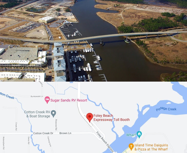
Foley Beach Express is a 14.0-mile-long limited-access four-lane partial toll road near the beaches of Baldwin County near the Gulf of Mexico in the southwestern part of the U.S. state of Alabama.
It serves as an alternate route for the heavily traveled State Route 59 in nearby Gulf Shores.
Toll rate: https://www.beachexpress.com/TollRates.aspx
- Montgomery Expressway
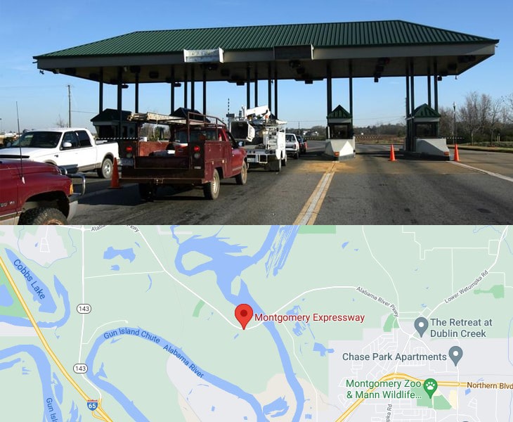
Montgomery Expressway connects Alabama’s capital city with its neighboring communities north of town.
The Montgomery Expressway bridge spans the Alabama River on the north side of the city, making for easy access to Millbrook and Prattville.
Toll rate: https://www.montgomeryexpressway.com/Toll.aspx
2. California
- Highway 1 Gate – 17 Mile Drive
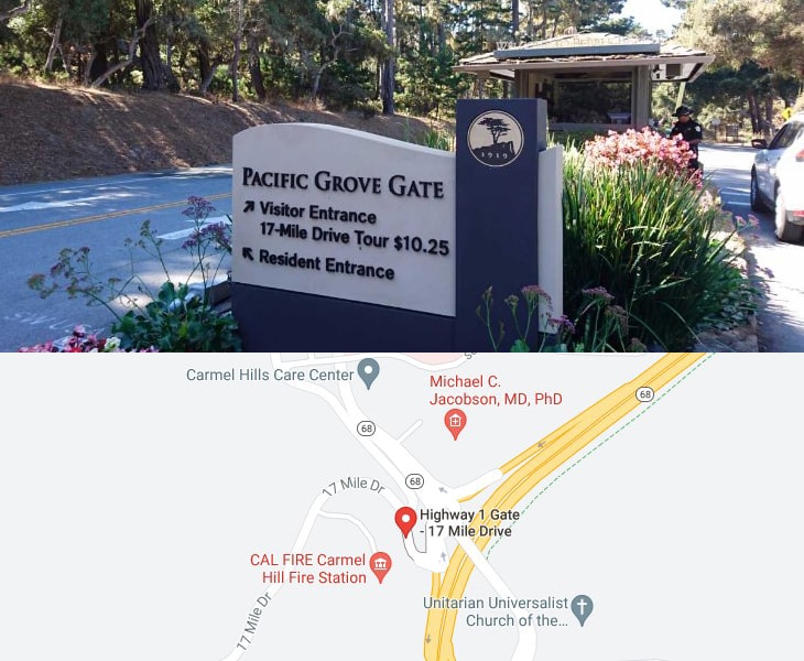
17-Mile Drive is a scenic road through Pebble Beach and Pacific Grove on the Monterey Peninsula in California.
Admission to 17-Mile Drive is $10.75 per vehicle.
- South Bay Expressway
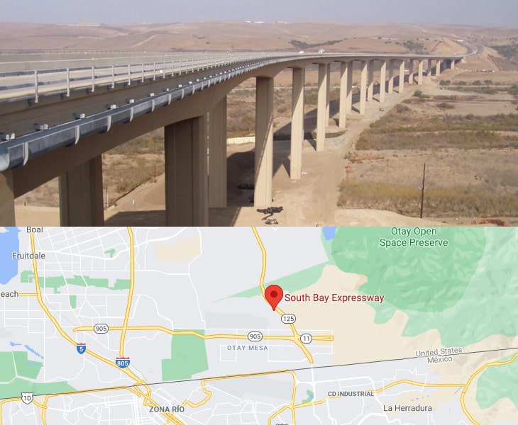
Tolls now range from 50 cents to $2.75 for FasTrak users and from $2 to $3.50 for cash / credit card users.
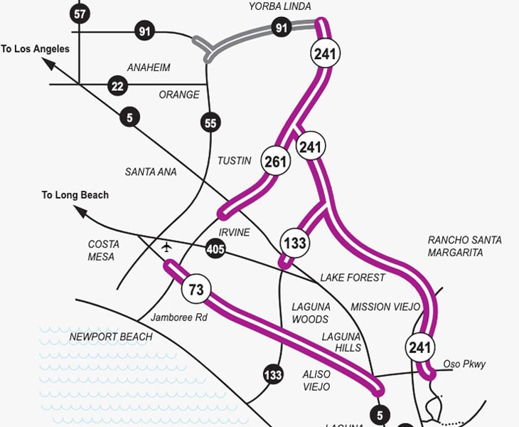
- Eastern Toll Road or Eastern Turnpike
3. Colorado
- E-470 Denver
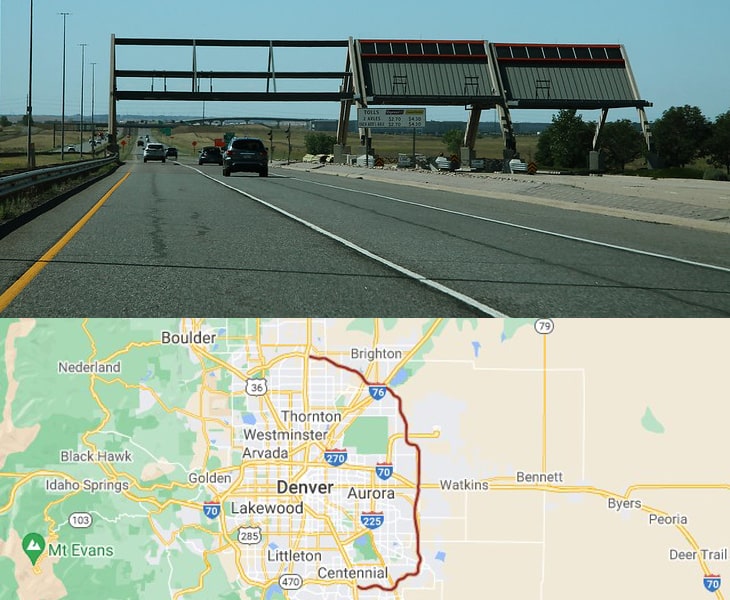
Over the 47 miles of the E-470, there are five different toll plazas you must pass through.
Each of these plazas costs $3, making it very costly to travel on this road.
Toll rate: https://www.e-470.com/toll-rates/
- Northwest Parkway
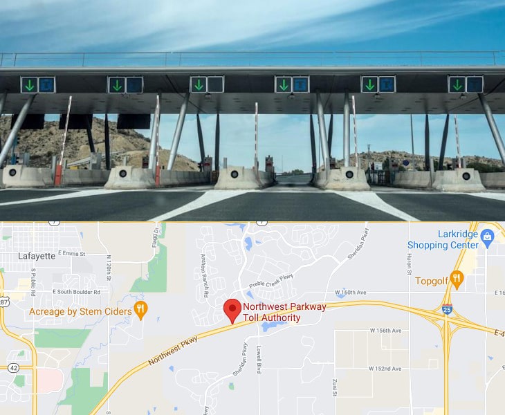
The Northwest Parkway is a 75 mile-per-hour toll road.
It is a public road and part of the Colorado highway system, connecting E-470 at I-25 in the north metro Denver area, with U.S. 36 in Broomfield, Colorado.
A toll transaction is recorded on the Northwest Parkway either by reading your vehicle license plate or ExpressToll transponder, when you drive through one of our three toll locations (Mainline Plaza, Sheridan, or U.S.287 ramp).
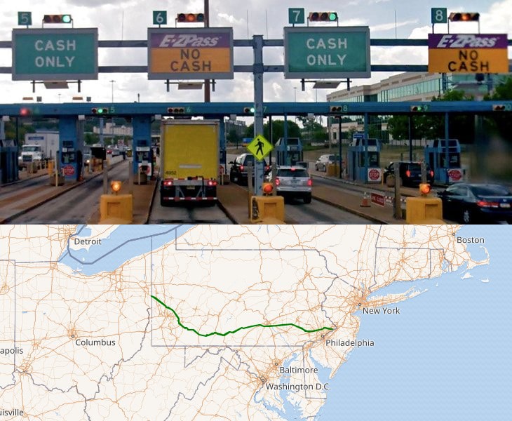
4. Delaware
- Delaware Turnpike
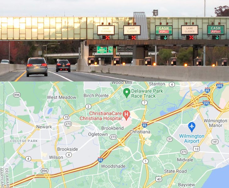
The Delaware Turnpike stretches 11 miles between Baltimore and Philadelphia, connecting the two major cities.
- Biddle’s Corner Toll Plaza
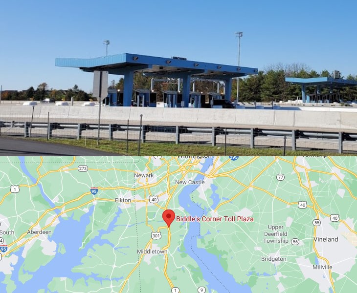
Toll rate: https://turnpikeinfo.com/view-exit.php?state=delaware&road_name=state-route-1&key=145_toll
- Dover Toll Plaza
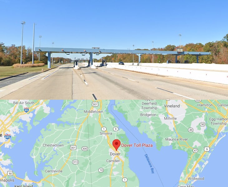
Toll rate: https://turnpikeinfo.com/view-exit.php?state=delaware&road_name=state-route-1&key=100_toll
- Delaware Memorial Bridge
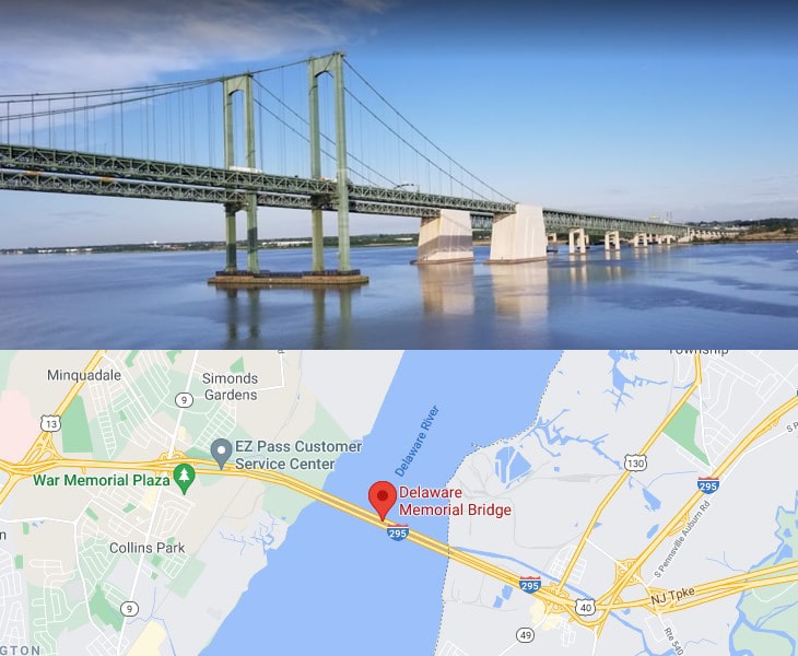
The Delaware Memorial Bridge is a twin suspension bridge crossing the Delaware River.
The toll bridges carry Interstate 295 and U.S. Route 40 between Delaware and New Jersey.
5. Florida
- State Road 417
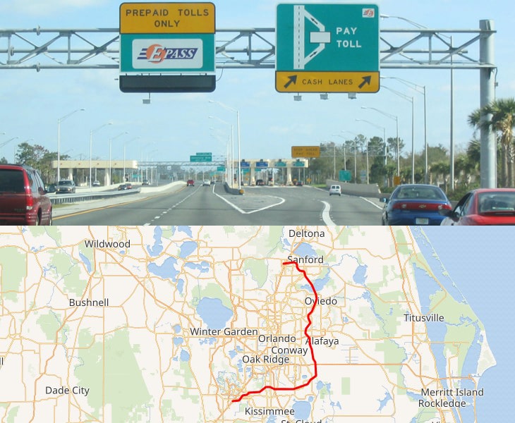
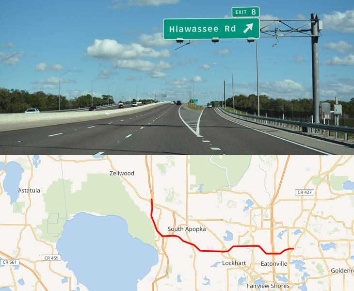
State Road 417, also known as the Central Florida GreeneWay, Seminole County Expressway, and Orlando East Bypass, is a tolled limited-access state highway forming the eastern beltway around the city of Orlando, Florida.
- SR 408 (East West Expressway)
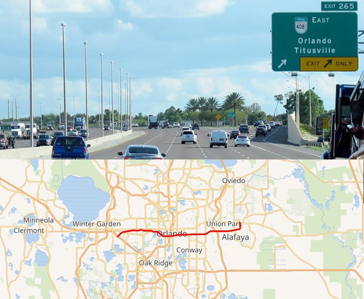
State Road 408, officially named the Spessard L. Holland East–West Expressway, is a tolled expressway running east–west through Orlando, Florida, United States.
- SR 414 (Apopka Expressway)
State Road 414 is a state highway in the U.S. state of Florida encompassing the John Land Apopka Expressway and Maitland Boulevard.
- SR 429 (Western Beltway)
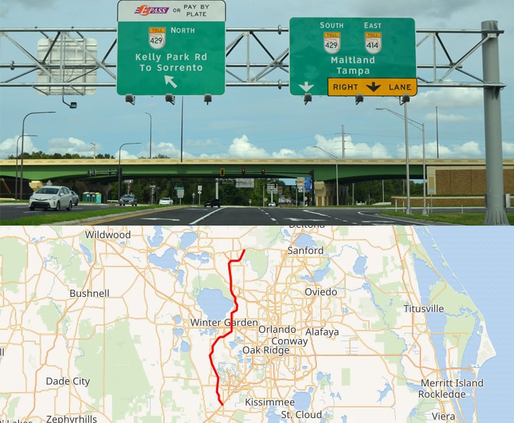
State Road 429, also known as the Daniel Webster Western Beltway or Western Expressway south of U.S. Highway 441 and the Wekiva Parkway north of U.S. Highway 441.
- SR 528 (Beachline Expressway)
State Road 528, alternatively named the Martin Andersen Beachline Expressway, is a partially-tolled state road in the U.S. state of Florida; it is maintained by the Florida’s Turnpike Enterprise, the Central Florida Expressway Authority, and the Florida Department of Transportation.
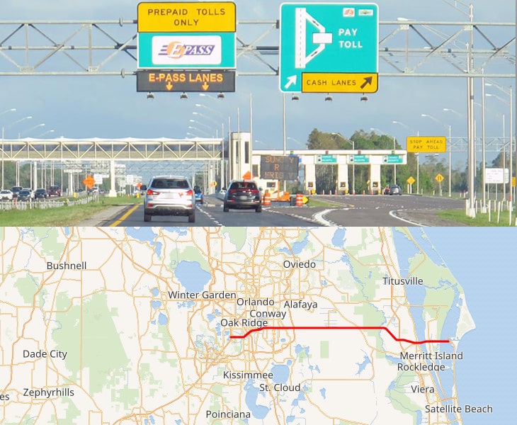
- Florida Turnpike
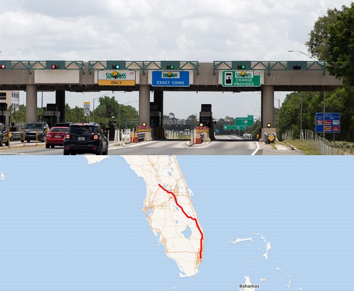
Florida’s Turnpike, designated as unsigned State Road 91 (SR 91), is a toll road in the U.S. state of Florida, maintained by Florida’s Turnpike Enterprise (FTE). Spanning approximately 309 miles along a northwest–southeast axis, the turnpike is in two sections.
Toll rate: https://floridasturnpike.com/TollCalc/index.htm
6. Georgia
There are no toll roads in Georgia currently. However, it has a few express lanes where toll has to be paid.
- The I-85 Express Lanes is a 15 mile corridor that connects Chamblee Tucker Road to Old Peachtree Road in Gwinnett County.
- The I-85 Express Lanes Extension is located entirely within Gwinnett County. It begins north of the existing I-85 Express Lanes at Old Peachtree Road and extends to Hamilton Mill Road.
- The I-75 Express Lanes is a reversible toll lane and runs 12 miles from State Route 155 McDonough Road in Henry County to State Route 138 Stockbridge Highway in Clayton County.
- The Northwest Corridor Express Lanes connects traffic between northwest Atlanta and Cobb and Cherokee counties.
The minimum toll rate for all Georgia Express Lanes is $0.10 per mile.
You can also expect toll rates above the $0.10 per mile minimum to vary based on travel conditions at each express lane facility rather than a predetermined max rate.
During periods of very low demand, per mile toll rates on an express lane facility may be replaced with a fixed toll of $0.50 per trip, regardless of the length of the trip.
7. Indiana
- Indiana Toll Road
The Indiana Toll Road serves as a critical transportation link between highways leading to major East Coast cities and northwestern Indiana, the City of Chicago, and the western U.S.
Toll rate: https://www.indianatollroad.org/travel-information/#calculator
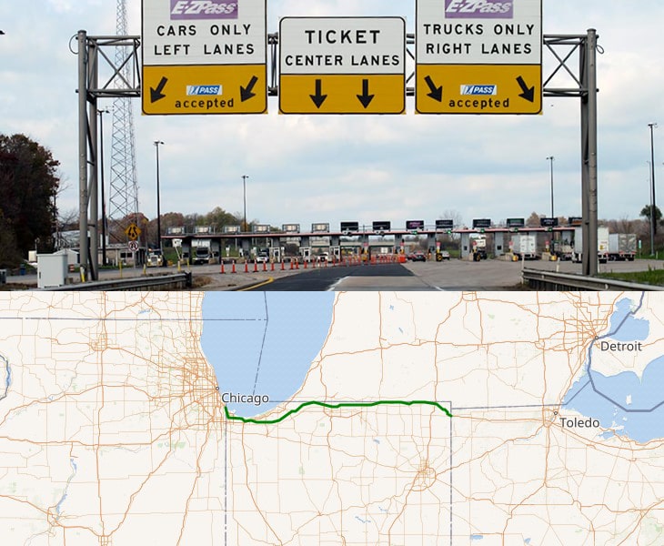
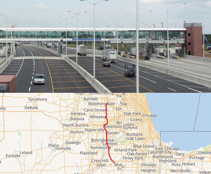
8. Illinois
- Chicago Skyway
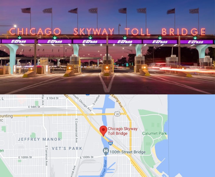
The Chicago Skyway Toll Bridge is a 7.8-mile-long toll road that connects the Indiana Toll Road to the Dan Ryan Expressway on Chicago’s South Side.
The main feature of the Skyway is a 1⁄2-mile-long steel truss bridge, known as the “High Bridge”.
Toll rate: https://www.chicagoskyway.org/toll-information/
- Jane Addams Memorial Tollway
Jane Addams Memorial Tollway (previously called the Northwest Tollway) runs from South Beloit to O’Hare Airport. It`s 76-mile toll road.
Toll rate: https://www.illinoistollway.com/toll-rates#Jane
- Tri-State Tollway
The Tri-State Tollway is a toll highway in the northeastern part of the US state of Illinois.
It follows:
- Interstate 80 from South Holland at I-94, and Illinois Route 394 (IL 394) to Hazel Crest;
- Interstate 294 from South Holland at I-80/I-94, and IL 394 to Northbrook; and
- Interstate 94 from Northbrook to the Wisconsin state line at Newport Township.
Toll rate: https://www.illinoistollway.com/toll-rates#TRI
The Ronald Reagan Memorial Tollway, originally known as the East-West Tollway, is a toll road in northern Illinois.
Toll rate: https://www.illinoistollway.com/toll-rates#Reagan
- Veterans Memorial Tollway
Interstate 355, also known as the Veterans Memorial Tollway, is an Interstate Highway and tollway in the western and southwest suburbs of Chicago in the U.S. state of Illinois.
Like most other toll roads in the northeastern portion of the state, I-355 is maintained by the Illinois State Toll Highway Authority.
Toll rate: https://www.illinoistollway.com/toll-rates#Reagan
- Illinois Route 390 Tollway
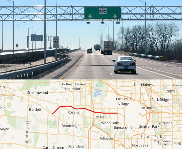
Illinois Route 390, previously known as the Elgin–O’Hare Expressway, now known as the Elgin–O’Hare Tollway, is a 9.8-mile-long electronic toll highway in northeastern Illinois.
IL 390 currently connects U.S. Route 20 in Hanover Park to the intersection with Illinois Route 83 and Thorndale Avenue in Wood Dale.
Toll rate: https://www.illinoistollway.com/toll-rates#Route390
9. Kansas
- Kansas Turnpike
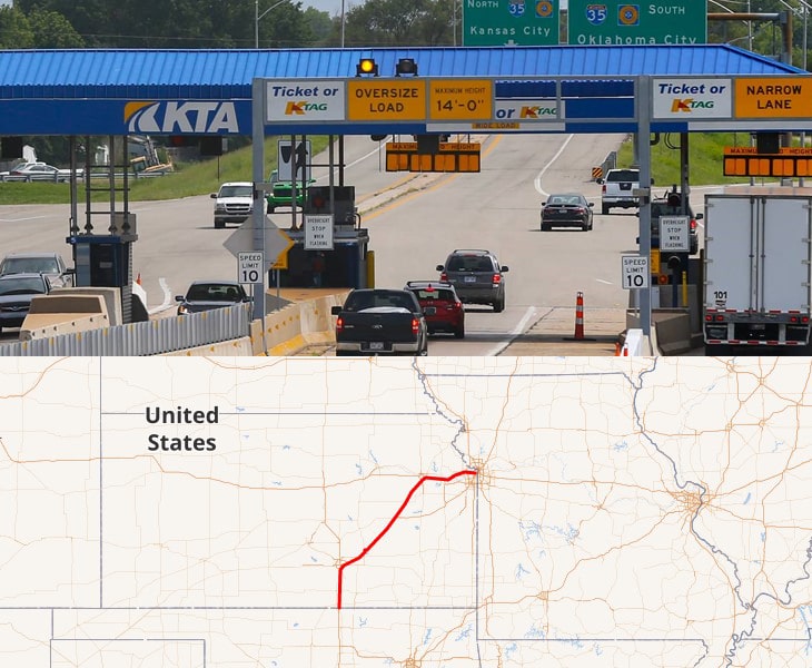
The Kansas Turnpike is a 236-mile-long, freeway-standard toll road that lies entirely within the U.S. state of Kansas.
It runs in a general southwest–northeast direction from the Oklahoma border to Kansas City.
Toll rate: https://www.ksturnpike.com/assets/uploads/content-files/2018_Cash_Public_Chart.pdf
10. Kentucky
Three bridges connecting Louisville, Kentucky and Southern Indiana are tolled: the I-65 Lincoln and Kennedy bridges and the SR 265/KY 841 Lewis and Clark Bridge.
- Abraham Lincoln Bridge
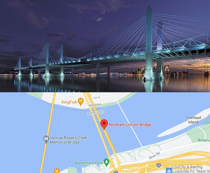
Toll rate: https://turnpikeinfo.com/toll-calculator.php?road_name=abraham-lincoln-bridge&state=kentucky
- John F. Kennedy Memorial Bridge
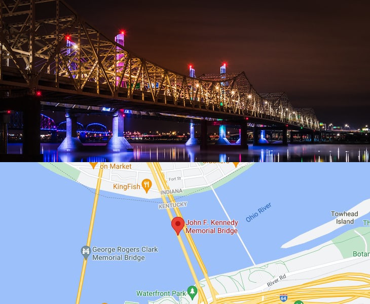
Toll rate: https://turnpikeinfo.com/toll-calculator.php?road_name=john-f-kennedy-memorial-bridge&state=kentucky
- Lewis and Clark Bridge
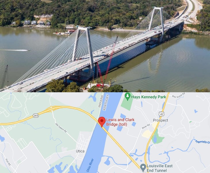
Toll rate: https://turnpikeinfo.com/toll-calculator.php?road_name=lewis-and-clark-bridge&state=kentucky
11. Louisiana
- Louisiana Highway 1 Bridge
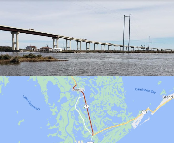
The Louisiana Highway 1 Bridge, also known as the Gateway to the Gulf Expressway is a concrete trestle toll bridge long 8.26 miles.
Two-axle vehicles pay $5.00 toll with cash and $3.00 with a Toll Tag.
12. Maine
- Maine Turnpike
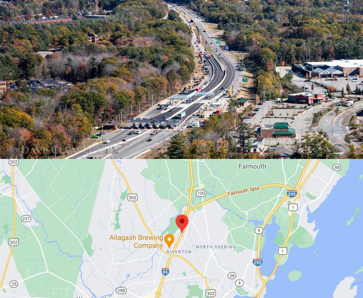
The Maine Turnpike is a toll road for all of its length except south of York and between Auburn and Sabattus.
Flat-fee tolls are paid upon entering the turnpike and at toll barriers in York, New Gloucester, and West Gardiner.
Toll rate: https://www.maineturnpike.com/Traveler-Services/Tolls.aspx
13. Massachusetts
- Massachusetts Turnpike
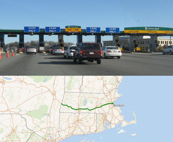
The Massachusetts Turnpike (colloquially “Mass Pike” or “the Pike” is a toll highway in the U.S. state of Massachusetts that is maintained by the Massachusetts Department of Transportation (MassDOT).
The turnpike begins at the New York state line in West Stockbridge, linking with the Berkshire Connector portion of the New York State Thruway.
Spanning 138 miles along an east–west axis, it is entirely concurrent with the portion of Interstate 90 (I-90) that lies within the state.
Toll rate: https://turnpikeinfo.com/toll-calculator.php?road_name=massachusetts-turnpike&state=massachusetts
14. North Carolina
- Triangle Expressway
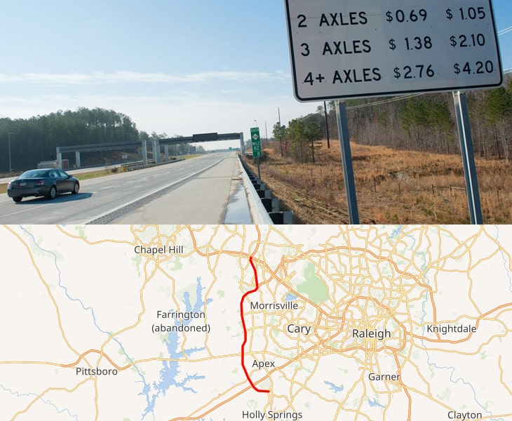
The Triangle Expressway is the first modern toll road built in North Carolina, and one of the first toll roads in the United States built to use only electronic toll collection instead of toll booths.
Tolls rates: https://www.ncquickpass.com/rates-facilities/Pages/triangle-expressway.aspx
- Monroe Expressway
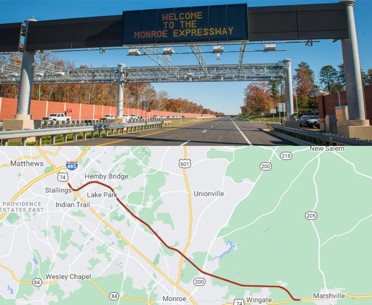
The Monroe Expressway is an alternative route to the U.S. 74 corridor located southeast of Charlotte, extending from Stallings to Marshville in Union County.
Also known as Toll U.S. 74 Bypass, the Monroe Expressway is North Carolina’s newest all-electronic toll road, meaning no toll booths and no stopping.
Toll rates: https://www.ncquickpass.com/rates-facilities/Pages/monroe-expressway.aspx
15. New Jersey
- New Jersey Turnpike
The New Jersey Turnpike is a system of controlled-access highways in the U.S. state of New Jersey, maintained by the New Jersey Turnpike Authority.
While the cost per toll varies based on the closed billing system, it typically costs 11.4 cents per mile on this 122-mile road.
Toll rate: https://turnpikeinfo.com/toll-calculator.php?road_name=new-jersey-turnpike&state=new-jersey
- Garden State Parkway
The Garden State Parkway is a controlled-access toll road that stretches the north–south length of eastern New Jersey from the state’s southernmost tip near Cape May to the New York state line at Montvale.
Its name refers to New Jersey’s nickname, the “Garden State”.
Toll rate: https://turnpikeinfo.com/toll-calculator.php?road_name=garden-state-parkway&state=new-jersey
- Atlantic City Expressway
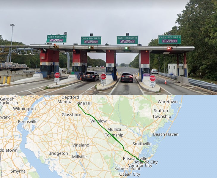
The Atlantic City Expressway is a 44.19-mile, controlled-access toll road in the U.S. state of New Jersey
Toll rate: https://www.sjta.com/ACEXPRESSWAY/toll_info.asp
16. New Hampshire
- Blue Star Turnpike
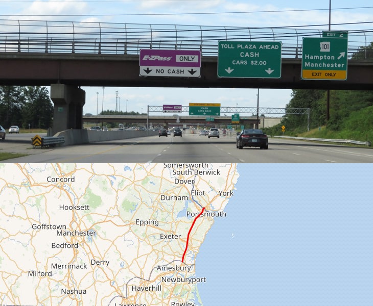
The Blue Star Turnpike segment of the Turnpike System extends from the Massachusetts state line in Seabrook to the Maine state line in Portsmouth.
It is 16.2 miles in length and constitutes a portion of I-95.The Blue Star Turnpike serves as the major connecting road between the states of Massachusetts and Maine.
Toll rate: https://turnpikeinfo.com/toll-calculator.php?road_name=blue-star-turnpike&state=new-hampshire
- Everett Turnpike
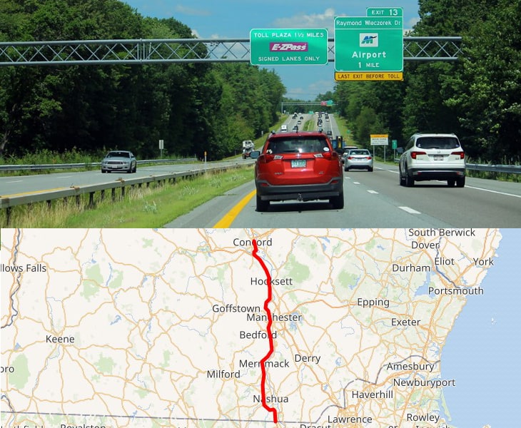
The Frederick E. Everett Turnpike, also called the Central New Hampshire Turnpike, is a toll road in the U.S. state of New Hampshire, running 44 miles from the Massachusetts border at Nashua north to Concord.
There are two mainline toll plazas on the turnpike, in Bedford and Hooksett.
Toll rate: https://turnpikeinfo.com/toll-calculator.php?road_name=everett-turnpike&state=new-hampshire
- Spaulding Turnpike
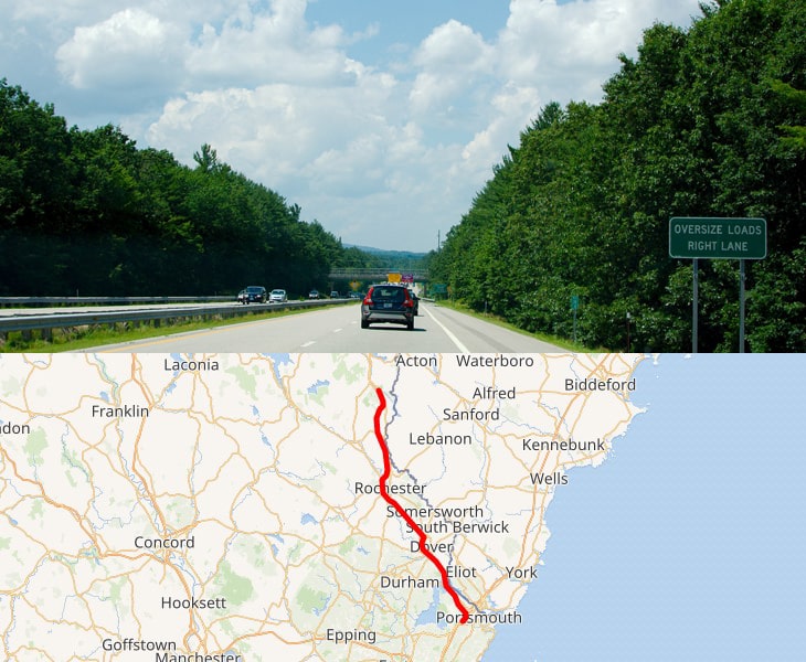
The Spaulding Turnpike segment of the Turnpike System extends from Portsmouth to Exit 18 in Milton.
It is 33.2 miles in length and is the major north-south artery in the eastern corridor of the state.
Toll rate: https://turnpikeinfo.com/toll-calculator.php?road_name=spaulding-turnpike&state=new-hampshire
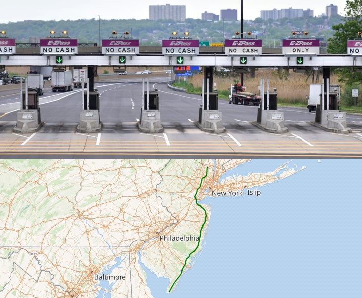
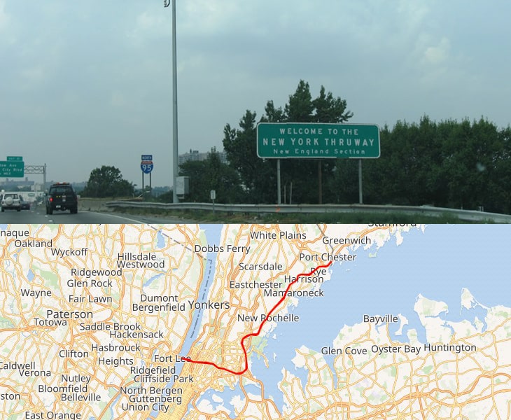
17. New York
- New England Thruway
Toll rate: https://turnpikeinfo.com/toll-calculator.php?road_name=new-england-thruway&state=new-york
- New York Thruway
The New York State Thruway is a system of controlled-access highways spanning 569.83 miles within the U.S. state of New York.
Toll rate: https://turnpikeinfo.com/toll-calculator.php?road_name=new-york-state-thruway&state=new-york
Interstate 190 is a north–south auxiliary Interstate Highway that connects I-90 in Buffalo, New York with the Canada-U.S. border near Niagara Falls.
Toll rate: https://turnpikeinfo.com/toll-calculator.php?road_name=niagara-thruway&state=new-york
18. Ohio
- Ohio Turnpike
The Ohio Turnpike, officially the James W. Shocknessy Ohio Turnpike, is a 241.26-mile-long limited-access toll highway in the U.S. state of Ohio, serving as a primary corridor to Chicago and Pittsburgh.
Toll rate: https://www.ohioturnpike.org/truckers
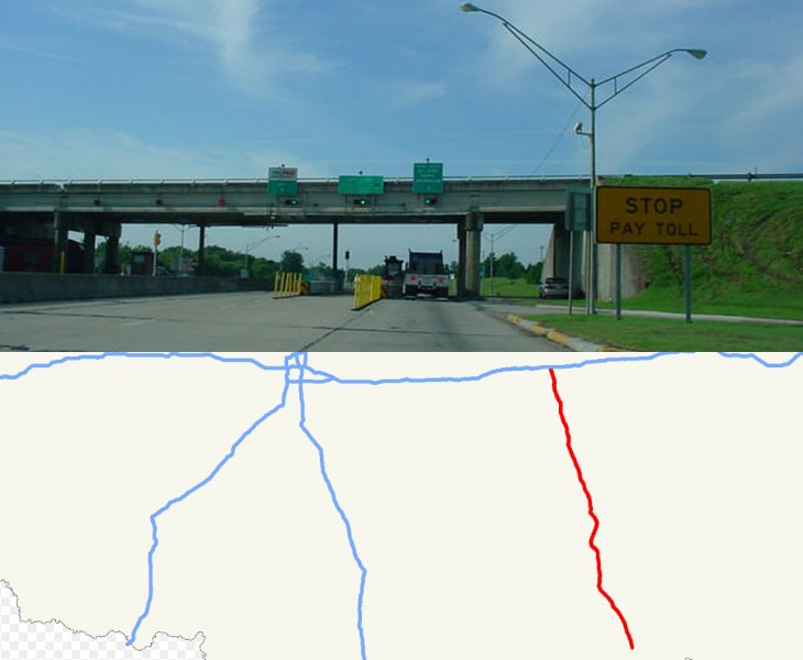
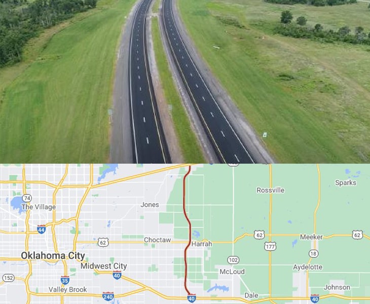
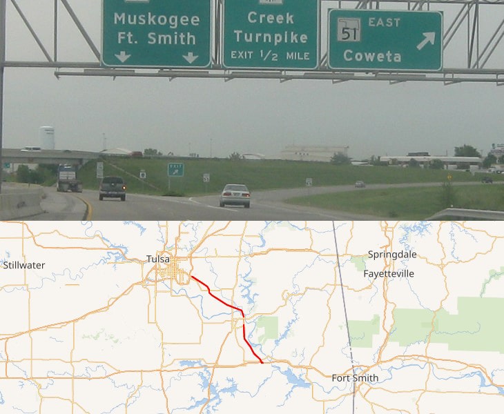
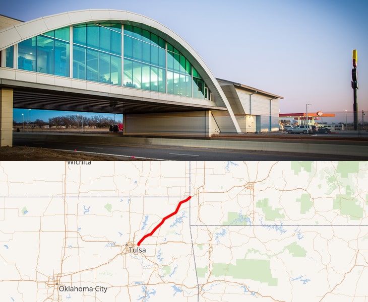
19. Oklahoma
- Cherokee Turnpike
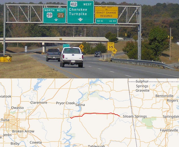
The Cherokee Turnpike is a toll road in eastern Oklahoma.
Opened in 1991, the route is a four-lane tollway carrying US-412 from east of Kansas, Oklahoma to east of Chouteau, and has a total length of 32.8 miles and a speed limit of 80 mph.
Toll rate: https://www.pikepass.com/toll/AllTollRates.aspx
- Chickasaw Turnpike
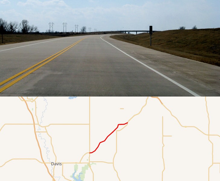
The Chickasaw Turnpike is a short toll road in the rural south central region of the U.S. state of Oklahoma.
A two-lane freeway, it stretches for 13.3 miles from north of Sulphur to just south of Ada.
Toll rate: https://www.pikepass.com/toll/TollCalculator.aspx
- Creek Turnpike
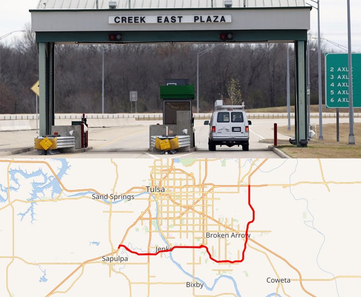
The Creek Turnpike, also designated State Highway 364, is a 33.22-mile-long freeway-standard toll road that lies entirely in the U.S. state of Oklahoma.
The turnpike forms a partial beltway around the south and east sides of Tulsa.
Toll rate: https://www.pikepass.com/toll/TollCalculator.aspx
- H. E. Bailey Turnpike
The H. E. Bailey Turnpike is an 86.4-mile toll road in the southwestern region of the U.S. state of Oklahoma.
Toll rate: https://turnpikeinfo.com/toll-calculator.php?road_name=h-e-bailey-turnpike&state=oklahoma
- Indian Nation Turnpike
The Indian Nation Turnpike is a toll road in southeastern Oklahoma, United States, running between Hugo and Henryetta, Oklahoma, a distance of 105.2 miles.
It is the longest tollway in the state.
Toll rate: https://turnpikeinfo.com/toll-calculator.php?road_name=indian-nation-turnpike&state=oklahoma
- Kickapoo Turnpike
The Kickapoo Turnpike is a 21-mile toll road.
Toll rate: https://turnpikeinfo.com/toll-calculator.php?road_name=kickapoo-turnpike&state=oklahoma
- Muskogee Turnpike
The Muskogee Turnpike, also designated State Highway 351, is a toll road in eastern Oklahoma.
Toll rate: https://turnpikeinfo.com/toll-calculator.php?road_name=muskogee-turnpike&state=oklahoma
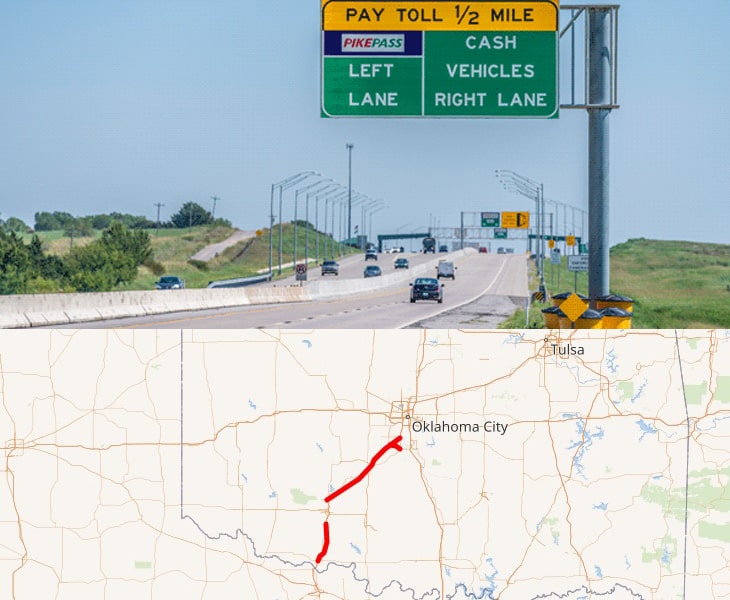
- Will Rogers Turnpike
The Will Rogers Turnpike is a freeway-standard toll road in the northeast portion of the U.S. state of Oklahoma.
The highway begins as a continuation of the Creek Turnpike in Tulsa.
Toll rate: https://turnpikeinfo.com/toll-calculator.php?road_name=will-rogers-turnpike&state=oklahoma
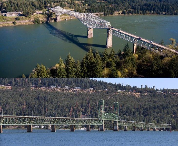
20. Oregon
Following are the toll bridges in Oregon:
– The Hood River-White Salmon Interstate Bridge spans Columbia River connecting Hood River, Oregon with the communities of White Salmon and Bingen in Washington State. The Bridge is limited to a Total Gross Weight Limit of 80,000 lbs., with each single axle limit of 20,000 lbs. Vehicles higher than 14 feet 7 inches are restricted to travel on the bridge. Cars, SUV, pickups, and RV without trailers pay $2.00 toll. Motorcycles pay $0.75.
– The Bridge of the Gods spans the Columbia River connecting SR-14 in Washington to I-84 in Oregon. Two-axle vehicles pay $2.00 toll unless you buy a coupon book.
20. Pennsylvania
- Pennsylvania Turnpike
It’s a controlled-access highway, it runs for 360 miles (580 km) across the state.
The turnpike begins at the Ohio state line in Lawrence County, where the road continues west as the Ohio Turnpike.
It ends at the New Jersey border at the Delaware River–Turnpike Toll Bridge over the Delaware River in Bucks County, where the road continues east as the Pearl Harbor Memorial Extension of the New Jersey Turnpike.
Toll rate: https://www.paturnpike.com/toll/tollmileage.aspx
21. South Carolina
- The Southern Connector Toll road
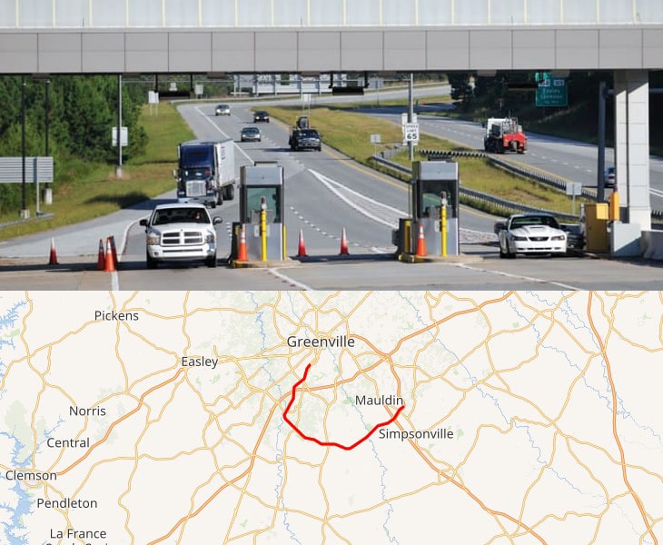
Interstate 185 is a 17.7-mile highway located entirely in Greenville County, South Carolina.
I-185 serves as a spur route of Interstate 85 into the city of Greenville as well as a shortcut route for drivers accessing Interstate 385 from northbound I-85.
Toll rate: https://www.southernconnector.com/rates-palpass.html
- The Cross Island Parkway
22. Texas
- Fort Bend Parkway Toll Road
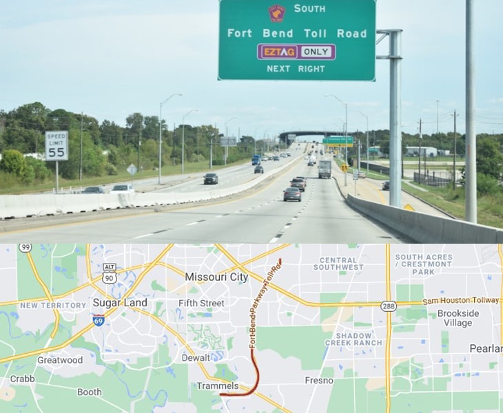
Beginning in Sugar Land, Texas, a suburb of Houston, the Fort Bend Parkway stretches for 7.5 miles and costs about $4 to get on, increasing in cost as you go.
The road is a commonly used way of getting to the Sam Houston Tollway, which is a larger road that circles downtown Houston.
Toll rate: https://www.fbctra.com/toll-roads/
- Texas State Highway 130
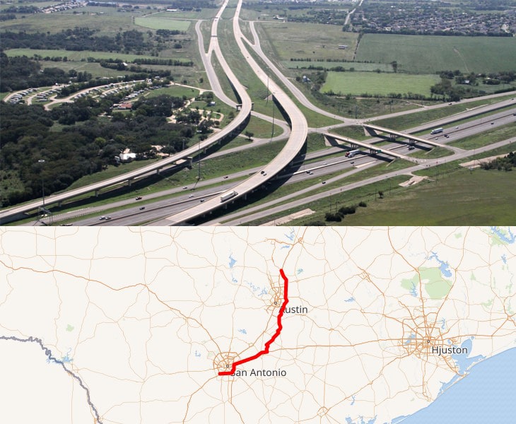
Extending from just north of Mustang Ridge at SH 45SE to I-10 in Seguin, SH 130 segments 5 & 6 connect to the northern segments of SH 130 that begin in Georgetown, forming a 91-mile safe, fast and reliable alternative to congested I-35 through Central Texas.
Toll rate: https://www.mysh130.com/about/toll-rates/
23. Utah
- Adams Avenue Parkway Toll
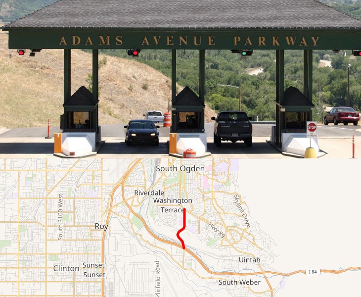
Adams Avenue Parkway is a one mile road that connects the local communities to I-84.
With quick access to I-84, you can bypass the stop lights, slow speed limits, and traffic congestion of other routes.
Toll rate: http://adamsavenueparkway.com/aap_004.htm
24. Vermont
Following are the toll roads in Vermont:
- Equinox Skyline Drive is scenic toll road connecting US-7A to the summit of Mount Equinox. Cars pay $20 and motorcycles pay $12. It costs $5 extra per passenger.
- The Burke Mountain Toll Road winds up to the Burke Mountain peak. If the weather permits, the toll road is open from 8:00 a.m. until 1/2 hour after sunset from May 1st until late October. Tolls are collected at the entrance. A day pass may cost $20 or $40 depending on the day of the week.
- Mt. Mansfield Toll Road ends at the summit of Mt. Mansfield, to the scenic views of Lake Champlain and the Adirondack Mountains.

Safety considerations dictate that some vehicles cannot be permitted on the Toll Road:
- No trailers, RVs, campers, or vans converted to RVs
- No dually trucks
- No mopeds or scooters
- No motorcycles
- No bicycles
25. Virginia
- The Chesapeake Expressway
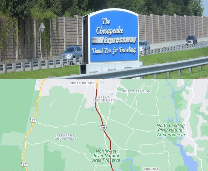
The Route 168 Chesapeake Expressway is a fast and convenient 16 mile long, four-lane divided highway linking Interstate 64 in Chesapeake to North Carolina and the Outer Banks
Toll rate: http://www.chesapeakeexpressway.com/
- Chesapeake Bay Bridge-Tunnel
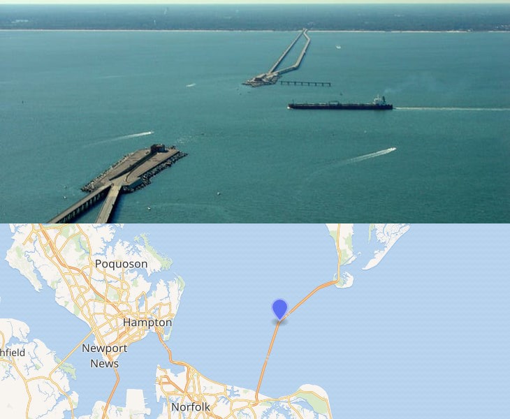
The Chesapeake Bay Bridge–Tunnel is a 17.6-mile bridge–tunnel crossing at the mouth of the Chesapeake Bay, the Hampton Roads harbor, and nearby mouths of the James and Elizabeth rivers in the U.S. state of Virginia.
Toll rate: http://www.cbbt.com/current-toll-schedule/
- Dulles Greenway (Route 267)
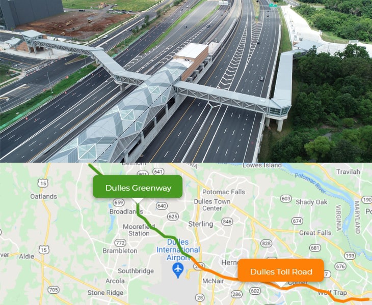
The Dulles Greenway is a privately owned toll road in Northern Virginia, running for 12.53 miles northwest from the end of the Dulles Toll Road to the Leesburg Bypass (U.S. Route 15/State Route 7).
- Dulles Toll Road (Route 267)
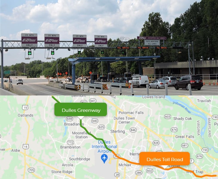
The Dulles Toll Road (Virginia Route 267) is an 8-lane, 14-mile (22.7 km) highway in Northern Virginia.
Toll rate: https://www.dullestollroad.com/toll/toll-rates
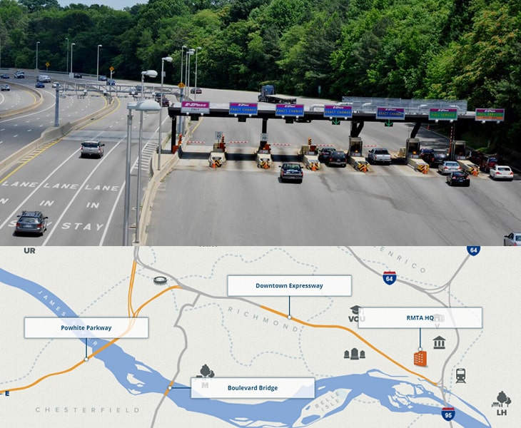
- RMA Expressway System
Thankfully, not every state charges insane highway tolls.
1. Alaska
2.Arizona
3.Arkansas
4.Connecticut
5.District of Columbia
6.Hawaii
7.Idaho
8. Iowa
9.Maryland
10.Michigan
11.Minnesota
12.Mississippi
13.Missouri
14.Montana
15.Nebraska
16. Nevada
17.New Mexico
18.North Dakota
19. Nevada
20.Rhode Island
21.South Dakota
22.Tennessee
23.Washington
24.Wisconsin
25.Wyoming
One the smartest ways for truckers to save money on tolls is by creating an account with the tolling facilities in the areas in which they will operate as there are often discounts offered.
Some of those are:
- E-ZPass/iPass: Covers 16 states in triangle-shaped region from Illinois in the West to Maine in the north down to Virginia in the mid-Atlantic.
- SunPass: Covers all of Florida and is interoperable with several states in the Southeast US.
- TxTag: Covers all of Texas.
- FasTrak: Covers certain toll roads and bridges California.
Also, it`s best to calculate toll costs for a route and find alternate routes with fewer tolls, which can result in savings in some regions.
Links:
https://www.tollsmart.com/truck-toll-calculator/